“King County Metro Route 40 | NFI D40LF | Ballard (Leary Ave NW @ NW Market St)” by Han Zheng is licensed under CC BY-SA 2.0.
After working in tech, where force-feeding disruptive changes to users is commonplace, the world of public transit planning feels like a group of indecisive friends struggling to decide on a place to eat. Modifications to bus routes involve consulting a litany of stakeholders. Those aren’t just riders, but businesses and residents along the route, as well as groups representing other road users. For the RapidRide J Project, a joint effort of King County Metro and the Seattle Department of Transportation (SDOT) that is converting the former’s route 70 to a Bus Rapid Transit line, outreach started in 2015. Unfurling the Outreach Conducted to Date section on its project page reveals almost 100 sessions. The commonality among all of them is that they involve parties who are geographically close to the course of the modified route.
That makes some sense. Those who will be most impacted by the construction associated with the project, and the ongoing operations of the route, will be close to its stops. Yet it would be a mistake to think that the project’s benefits will be similarly limited in their reach.
As part of my previous analysis of the percent replaceable of transit routes, I needed to determine every sector where a given route was part of the fastest path to any other sector at some time of day. If a walkshed is the region wherein a person is considered within walking distance of a point, the routeshed of a route, analogously, is the extent of the area wherein it improves a rider’s ability to reach other points within a time budget. The following table shows the size of the routeshed for every King County Metro route with service in Seattle, given a 30-minute time budget.
| Route | Routeshed Size (Sectors) | % of Seattle Area |
|---|---|---|
| 1 Line | 27,436 |
84.5% |
| 62 | 24,902 |
76.7% |
| E Line | 23,456 |
72.3% |
| 40 | 23,408 |
72.1% |
| 5 | 23,248 |
71.6% |
| 60 | 22,164 |
68.3% |
| 21 | 22,134 |
68.2% |
| 28 | 21,481 |
66.2% |
| H Line | 21,393 |
65.9% |
| 8 | 21,224 |
65.4% |
| C Line | 21,171 |
65.2% |
| D Line | 21,121 |
65.1% |
| 70 | 20,691 |
63.8% |
| 4 | 20,673 |
63.7% |
| 49 | 20,622 |
63.5% |
| 132 | 20,385 |
62.8% |
| 48 | 20,067 |
61.8% |
| 124 | 19,901 |
61.3% |
| 150 | 19,632 |
60.5% |
| 131 | 19,416 |
59.8% |
| 44 | 19,393 |
59.8% |
| 125 | 18,978 |
58.5% |
| 43 | 18,393 |
56.7% |
| 545 | 18,121 |
55.8% |
| 36 | 18,057 |
55.6% |
| 33 | 17,750 |
54.7% |
| 32 | 17,746 |
54.7% |
| 13 | 17,727 |
54.6% |
| G Line | 17,671 |
54.5% |
| 1 | 17,666 |
54.4% |
| 101 | 17,605 |
54.2% |
| 24 | 17,582 |
54.2% |
| 45 | 17,461 |
53.8% |
| 31 | 17,409 |
53.6% |
| 2 | 17,288 |
53.3% |
| 11 | 17,051 |
52.5% |
| 550 | 17,033 |
52.5% |
| 14 | 16,710 |
51.5% |
| 67 | 16,457 |
50.7% |
| 50 | 16,357 |
50.4% |
| 554 | 16,304 |
50.2% |
| 7 | 16,169 |
49.8% |
| 75 | 16,076 |
49.5% |
| 322 | 15,796 |
48.7% |
| 3 | 15,780 |
48.6% |
| 65 | 15,427 |
47.5% |
| First Hill Streetcar | 15,307 |
47.2% |
| 27 | 14,975 |
46.1% |
| 372 | 14,757 |
45.5% |
| 12 | 14,701 |
45.3% |
| 10 | 14,655 |
45.2% |
| 177 | 14,462 |
44.6% |
| 61 | 14,439 |
44.5% |
| 79 | 14,433 |
44.5% |
| 102 | 14,381 |
44.3% |
| 106 | 14,210 |
43.8% |
| 57 | 14,053 |
43.3% |
| 542 | 13,987 |
43.1% |
| 17 | 13,778 |
42.5% |
| 9 | 13,361 |
41.2% |
| 311 | 13,031 |
40.2% |
| 56 | 12,551 |
38.7% |
| 255 | 12,505 |
38.5% |
| 365 | 12,360 |
38.1% |
| 212 | 12,259 |
37.8% |
| 107 | 12,150 |
37.4% |
| 522 | 12,115 |
37.3% |
| 345 | 12,081 |
37.2% |
| 348 | 12,027 |
37.1% |
| 257 | 11,741 |
36.2% |
| South Lake Union Streetcar | 11,525 |
35.5% |
| 556 | 11,117 |
34.3% |
| 271 | 11,022 |
34.0% |
| 113 | 10,063 |
31.0% |
| 162 | 9,583 |
29.5% |
| 111 | 9,447 |
29.1% |
| 988 | 9,373 |
28.9% |
| 303 | 8,985 |
27.7% |
| 128 | 8,827 |
27.2% |
| 987 | 8,469 |
26.1% |
| 773 | 8,030 |
24.7% |
| 218 | 7,843 |
24.2% |
| 193 | 7,313 |
22.5% |
| 630 | 7,103 |
21.9% |
| 22 | 7,007 |
21.6% |
| 333 | 5,264 |
16.2% |
| 775 | 4,578 |
14.1% |
| 982 | 3,856 |
11.9% |
| 986 | 2,786 |
8.6% |
| 989 | 1,852 |
5.7% |
| 981 | 912 |
2.8% |
As I mentioned in the percent replaceable analysis, I was surprised by how large the routesheds are, particularly for the top routes. Consider this map of route 70, which shows the limited area of Seattle that it covers. Yet if a person originates at a point within 63.8% of the city’s land area, there is some time of day where route 70 will be part of the fastest way to get them to another place in it, even when considering only the trips that can be made within 30 minutes.
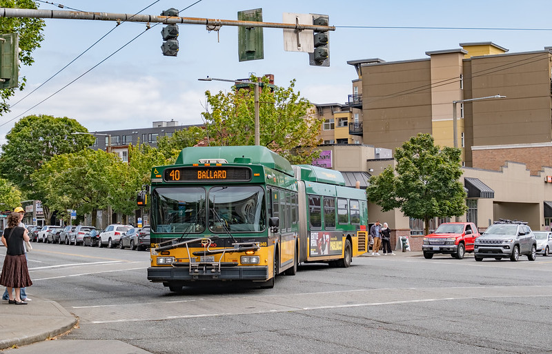
Construction is also underway to improve speed and reliability for route 40. It ranks even higher than route 70 in routeshed size, at fourth place within Seattle. For the route 40 project, the outreach period has not been as protracted, but a similar emphasis has been placed on creating opportunities to meet with agency staff directly along the route. This is in spite of the route being relevant in 72.1% of the land area of Seattle.
Anyone is entitled to send an email with feedback on the project, so what’s the harm in additional opportunities for providing it in-person along the route? The outreach events that these agencies host indicate that they do not see the passive solicitation of email feedback as sufficient. The in-person meetings along the route, and the proactive involvement of community groups, are intended to remove barriers to providing feedback. The problem is that the ability to make a forceful case in person to agency staff is only being extended to those who spend their time in proximity to points along the route. An individual who uses the route as part of the middle leg of a three-seat ride, or walks a long way to or from their stop, is a valid user of the route, but is unlikely to just be in the neighborhood when an outreach event takes place. Their narrative about how the project will improve their transit trips will be underweighted, and less able to counterbalance complaints about a loss of parking or the temporary inconveniences brought about by construction.
On top of that, if the project is successful, route 40’s routeshed will only be getting larger. The routeshed is merely a lower bound on where the project could have a benefit, and yet it is much larger than the areas targeted for outreach.
I find this to be emblematic of a larger problem within public transit planning. Routes are treated as local assets; they are thought to benefit the people who live or work within some fixed area of their stops. That’s not true, and thinking in this way devalues public transit service. The routeshed measurement underscores that many of King County Metro’s routes can provide value to those present in large swaths of Seattle. This is even when only considering a modest 30-minute time budget, and most transit riders occasionally tolerate a longer one. Changes to a single route have network-wide reverberations; all aspects of public transit planning ought to reflect that. If extensive outreach is integral to the process of transit planning, its current lack of geographic breadth is undercutting its purpose.